Other Environmental Matters
Salt Ion Data and Comparisons Across Years
In 2020 Salt ion data was collected by the Six Ponds Association and analyzed by Envirotech for the first time since 2008.
The comparison of the averages for salt ions analyzed by Emvirotech in water samples from 2002 through 2006 with the salt ions analyzed in 2020 is striking.
The readings in 2020 for chloride, potassium, calcium and sodium were nearly twice what they averaged over 2002 through 2006. In both cases, the readings for Bloody Pond were highest, Little Long Pond was next, and Long Pond was third. The earlier readings seemed alarming at the time, but the more recent readings were far worse.
From 2002 to 2006, Envirotech analysis of salt ions was included in all of the Six Ponds water samples from all 6 of our ponds. However, in the PALS analyses in 2008 only sodium was analyzed, from 2009 through 2013 no salt ions were analyzed, and from 2104 to the present no salt ions were included in the PALS analyses.
The findings reported above indicate that it was a mistake to exclude salt ions from analyses over the past 10-plus years. These findings also indicate the importance of having several years of earlier data to compare with current data in order to gain some understanding of what is going on.
_______________________________________________________
Supporting Observations Regarding Salt Ions and Runoff
The Six Ponds Association’s water quality work continues to identify problems which may require attention and remediation.
Much of our work to date has focused on the nutrient pollutants, phosphate and nitrate, and the concentrations of e-coli in our ponds, but recent analyses of our data have caused us to consider the possible impacts of other contaminants. Specifically, we have found that salts, components of salts, and other contaminants often seen in highway, road and driveway runoff are showing up in some of our ponds. Moreover, the three ponds with the highest concentrations are those closest to paved roadways where storm drains and the roads themselves channel runoff directly into our ponds or onto land close to our ponds.
These results may have implications for road construction, storm drain construction and best management practices (BMPs) for remediation in the vicinity of water bodies. The BMPs recommended for remediating runoff problems are retention systems and these are usually paid for with 604(b) government grants. Six Ponds applied unsuccessfully for a 604(b) grant several years ago, but, given our recent findings, we think it is important to try again.
We have long suspected that stormwater runoff may be affecting our ponds in many ways, but we have not had sufficient data for clear patterns to emerge. Statistical processing of the chemical analyses of more than 150 water samples has now revealed interesting and disturbing patterns which strongly suggests that road runoff is having an impact.
With regard to seven chemical parameters suggesting runoff problems, we have found Bloody Pond to have the highest quantities, Little Long Pond to be next highest, Long Pond third, Halfway Pond fourth, Round Pond fifth, and Gallows Pond to have the lowest quantities.
In the discussion below, we have tried to understand how the observable characteristics of each pond may contribute to the findings. To that end, we have examined housing and terrain characteristics, the types of roads surrounding each pond, and some of the drainage characteristics which may contribute to runoff problems for each pond. Another web link below will take you to an interpretation of why we think the quantities of the seven runoff parameters involved may be related to the amounts of stormwater runoff being discharged into our ponds from paved roads and storm drains.
1. Bloody Pond bottle samples exhibited the highest concentrations of salts, salt components and possible highway runoff indicators. The pond was highest on Specific Conductance, Sodium, and Chloride, and second highest on Calcium, Magnesium and Hardness.
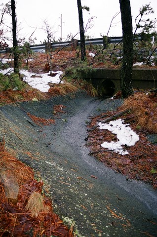
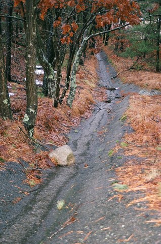
The pond has a moderate number of houses on its western side, and the slope to the pond is fairly steep on the west, north and east. The northeastern end and eastern side of the pond is close to the southbound lanes of Route 3 (see Catch Basins along Route 3 ). Highway runoff flows from both directions to a relatively low area in Route 3 near the northern end of Bloody Pond. Drainage from the highway grates comes out of pipes on the steep slope down from the highway, is channeled down the slope to a small abandoned cranberry bog northeast of Bloody Pond, flows through the ditches of the bog toward Bloody Pond, and then flows through an abandoned bog flume into Bloody Pond. The Baird Center is on the northern end of the pond, and the roads in this area are paved and used on a year-round basis. On the northwestern side of the pond, there is Timberline Lane which is paved road running down a steep hill through a small subdivision. Runoff which comes down Timberline flows into drains which then pipe the runoff into a low wetland area on the west side of the road but not very far from the pond. Although Long Pond Road runs along the west side of the pond at the crest of the pond’s watershed, this paved road is some distance from the pond.
2. Little Long Pond exhibited the next highest concentrations of salts, salt components and possible runoff indicators. It was highest on Calcium, Magnesium, Hardness and Alkalinity, and second highest on Specific Conductance, Chloride, and Sodium.
There are many houses on or near the pond, and its sides are very steep on the north and the east. Many of the driveways are paved. Several paved roads lie to the north and the east of the pond-- Independence Way and Unity Circle lie just to the north, Long Pond Road is parallel to the northeastern side, Oar and Line Road lies just to the east. It appears that some of the storm drains on these roads
may pipe or channel runoff into Little Long Pond. This possibility requires further investigation.
3. Long Pond ranked third in concentrations of possible runoff indicators. It had the third highest values on all seven of these parameters (Specific Conductance, Sodium, Chloride, Calcium, Magnesium, Hardness and Alkalinity).
There are only a moderate number of houses on the pond given its large size, and the sides are fairly steep. The roads and driveways on the south and west sides of the pond are unpaved. At the northern end of Long Pond, a channel from Little Long Pond feeds nearly 3,000 gallons of water a minute into Long Pond, runoff from the paved parking lot for the State boat ramp on Long Pond flows into this channel, runoff which flows into storm drains in Plymouth Estates or flows down the road from Long Pond Road, Clark Road, Oar and Line Road and Thatcher Road (all paved roads) all ends up in this channel or runs down the State boat ramp into Long Pond.
4. Halfway Pond, Round Pond and Gallows Pond ranked fourth, fifth and sixth in this evidence of possible runoff problems. Although these ponds presented a somewhat mixed picture with respect to these seven parameters, all three of these ponds had lower values than any of the other three ponds on all but one of these parameters.
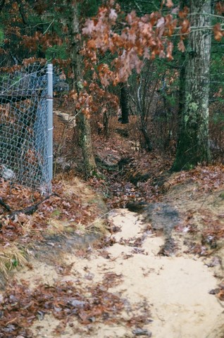
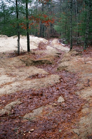
There are few houses on each of these ponds compared with the other three ponds. Except for Round Pond, the slopes to the ponds are shallow. The roads and driveways in close proximity to all three of these ponds are unpaved. At Halfway Pond, a long section of unpaved road lies only a couple feet from the pond, and in many places there is no buffer to prevent direct runoff into the pond.
Much of our work to date has focused on the nutrient pollutants, phosphate and nitrate, and the concentrations of e-coli in our ponds, but recent analyses of our data have caused us to consider the possible impacts of other contaminants. Specifically, we have found that salts, components of salts, and other contaminants often seen in highway, road and driveway runoff are showing up in some of our ponds. Moreover, the three ponds with the highest concentrations are those closest to paved roadways where storm drains and the roads themselves channel runoff directly into our ponds or onto land close to our ponds.
These results may have implications for road construction, storm drain construction and best management practices (BMPs) for remediation in the vicinity of water bodies. The BMPs recommended for remediating runoff problems are retention systems and these are usually paid for with 604(b) government grants. Six Ponds applied unsuccessfully for a 604(b) grant several years ago, but, given our recent findings, we think it is important to try again.
We have long suspected that stormwater runoff may be affecting our ponds in many ways, but we have not had sufficient data for clear patterns to emerge. Statistical processing of the chemical analyses of more than 150 water samples has now revealed interesting and disturbing patterns which strongly suggests that road runoff is having an impact.
With regard to seven chemical parameters suggesting runoff problems, we have found Bloody Pond to have the highest quantities, Little Long Pond to be next highest, Long Pond third, Halfway Pond fourth, Round Pond fifth, and Gallows Pond to have the lowest quantities.
In the discussion below, we have tried to understand how the observable characteristics of each pond may contribute to the findings. To that end, we have examined housing and terrain characteristics, the types of roads surrounding each pond, and some of the drainage characteristics which may contribute to runoff problems for each pond. Another web link below will take you to an interpretation of why we think the quantities of the seven runoff parameters involved may be related to the amounts of stormwater runoff being discharged into our ponds from paved roads and storm drains.
The ponds in the Six Ponds area are discussed below, ordered from those with the highest concentrations on these parameters to those with the lowest concentrations on these parameters. While the correlations described below between the chemical parameters and the physical characteristics of the ponds do not prove that road runoff is the problem, we think our observations suggest that road runoff is a significant contributing factor and indicate that our hypothesis deserves thorough investigation.
1. Bloody Pond bottle samples exhibited the highest concentrations of salts, salt components and possible highway runoff indicators. The pond was highest on Specific Conductance, Sodium, and Chloride, and second highest on Calcium, Magnesium and Hardness.
The pond has a moderate number of houses on its western side, and the slope to the pond is fairly steep on the west, north and east. The northeastern end and eastern side of the pond is close to the southbound lanes of Route 3 (see Catch Basins along Route 3 ). Highway runoff flows from both directions to a relatively low area in Route 3 near the northern end of Bloody Pond. Drainage from the highway grates comes out of pipes on the steep slope down from the highway, is channeled down the slope to a small abandoned cranberry bog northeast of Bloody Pond, flows through the ditches of the bog toward Bloody Pond, and then flows through an abandoned bog flume into Bloody Pond. The Baird Center is on the northern end of the pond, and the roads in this area are paved and used on a year-round basis. On the northwestern side of the pond, there is Timberline Lane which is paved road running down a steep hill through a small subdivision. Runoff which comes down Timberline flows into drains which then pipe the runoff into a low wetland area on the west side of the road but not very far from the pond. Although Long Pond Road runs along the west side of the pond at the crest of the pond’s watershed, this paved road is some distance from the pond.
2. Little Long Pond exhibited the next highest concentrations of salts, salt components and possible runoff indicators. It was highest on Calcium, Magnesium, Hardness and Alkalinity, and second highest on Specific Conductance, Chloride, and Sodium.
There are many houses on or near the pond, and its sides are very steep on the north and the east. Many of the driveways are paved. Several paved roads lie to the north and the east of the pond-- Independence Way and Unity Circle lie just to the north, Long Pond Road is parallel to the northeastern side, Oar and Line Road lies just to the east. It appears that some of the storm drains on these roads
may pipe or channel runoff into Little Long Pond. This possibility requires further investigation.
3. Long Pond ranked third in concentrations of possible runoff indicators. It had the third highest values on all seven of these parameters (Specific Conductance, Sodium, Chloride, Calcium, Magnesium, Hardness and Alkalinity).
There are only a moderate number of houses on the pond given its large size, and the sides are fairly steep. The roads and driveways on the south and west sides of the pond are unpaved. At the northern end of Long Pond, a channel from Little Long Pond feeds nearly 3,000 gallons of water a minute into Long Pond, runoff from the paved parking lot for the State boat ramp on Long Pond flows into this channel, runoff which flows into storm drains in Plymouth Estates or flows down the road from Long Pond Road, Clark Road, Oar and Line Road and Thatcher Road (all paved roads) all ends up in this channel or runs down the State boat ramp into Long Pond.
4. Halfway Pond, Round Pond and Gallows Pond ranked fourth, fifth and sixth in this evidence of possible runoff problems. Although these ponds presented a somewhat mixed picture with respect to these seven parameters, all three of these ponds had lower values than any of the other three ponds on all but one of these parameters.
There are few houses on each of these ponds compared with the other three ponds. Except for Round Pond, the slopes to the ponds are shallow. The roads and driveways in close proximity to all three of these ponds are unpaved. At Halfway Pond, a long section of unpaved road lies only a couple feet from the pond, and in many places there is no buffer to prevent direct runoff into the pond.
Related Information
For confirmation of the pattern of 7 parameters discussed above, see Plymouth-wide Testing in 2002 and 2003. In this case, it should be noted that the pattern suggesting road runoff problems is the same, but the concentration levels in several ponds are even greater. The ponds which stand out are Billington Sea, Fresh Pond, Jenny Pond and Micajah Pond.
Also, please see the following web site(s)
Is Highway Runoff a Serious Problem?
E-Coli Testing results
E-Coli results highlighted in 2002
Other E-Coli result from 1999 - 2003
The e-coli readings obtained from 1999, 2000 and 2001 were quite good. However, there were readings in 2002 and 2003 that were terribly dangerous. Most of these were recorded in road runoff, and all of them were obtained near a stream that runs adjacent to a swimming beach.
_____________________________________________________________


